
Draft Plan Consultation: Additional Housing Sites in Walsall (Regulation 18)
Ended on the 5th September 2022
Location of the additional housing sites
A summary and location map of each of the three sites that have been assessed as suitable for allocation in the Draft Back Country Plan is shown below. The detailed assessments of each of the sites are available on the BC Plan Website at: https://blackcountryplan.dudley.gov.uk/t2/p4/t2p4l/
Sites
WAH275 – Land West of Chester Road North of Little Hardwick Road, Streetly
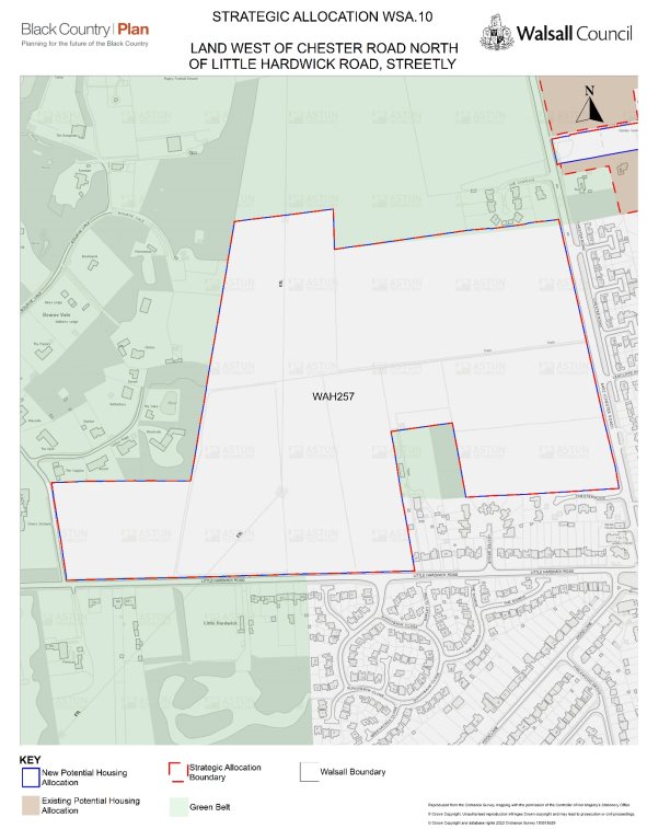
Site Ref
WAH275
Policy in Previous Local Plan (Site Allocation Document)
GB1
Indicative Housing Capacity
655
Gross Site area (ha)
25.98
Indicative Net Developable Area (ha)
18.73
Net Density (dwellings per hectare)
35
WAH276 – Land East of Skip Lane and North of Woodfield Close
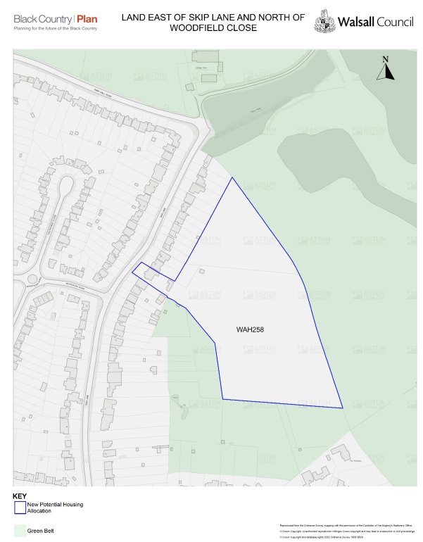
Site Ref
WAH276
Policy in Previous Local Plan (Site Allocation Document)
GB1, EN5 (part)
Indicative Housing Capacity
135
Gross Site area (ha)
3.44
Indicative Net Developable Area (ha)
2.58
Net Density (dwellings per hectare)
35
WAH277 – Pacific Nurseries (North), East of Chester Road
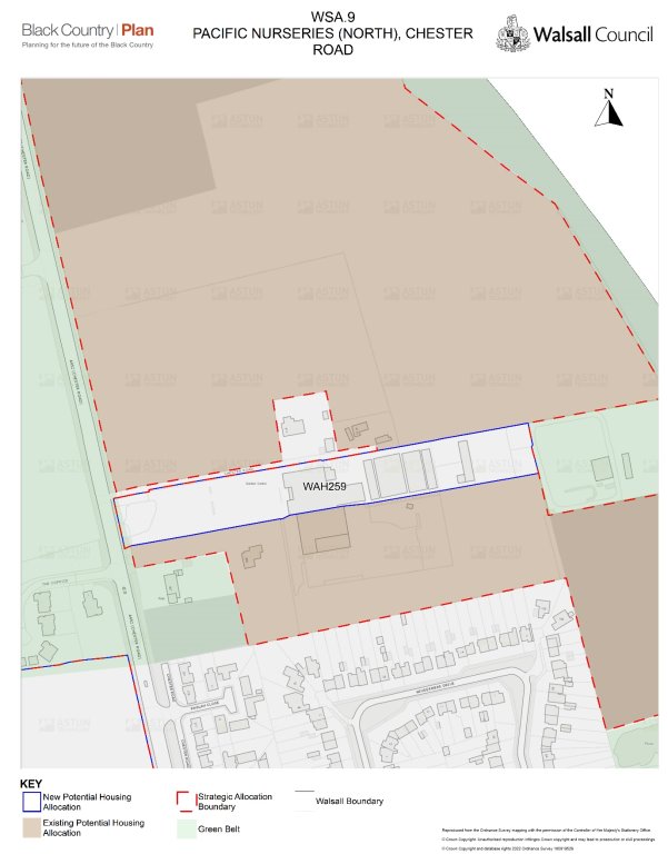
Site Ref
WAH277
Policy in Previous Local Plan (Site Allocation Document)
GB1
Indicative Housing Capacity
30
Gross Site area (ha)
1.15
Indicative Net Developable Area (ha)
0.86
Net Density (dwellings per hectare)
35
Need help completing this? Click here for our simple user guide.